
Office Software
Carlson CADnet Software
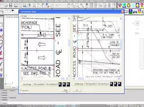
First released as a separate module in 2014, Carlson CADnet allows users to create CAD from non-CAD documents such as PDFs, raster images, and paper plans. CAD text can also be generated from raster images with CADnet’s built-in Optical Character Recognition (OCR).
CADnet gives users the ability to import BIM models (doors, windows, walls, roofs, etc.) and bring them into CAD as CAD entities; plus, CADnet includes a routine to export surfaces into BIM.
Carlson CADnet supports AutoCAD® and comes with IntelliCAD® built-in. This is in addition to working on legacy AutoCAD versions.
- Import PDF Files
- Import BIM using IFC Files
- Export Carlson surface to BIM using IFC Files
- Convert Raster images to vector CAD entities
- Modify Raster images using cut, copy, remove speckles and thicken commands
- Create CAD entities from the raster image using Trace functions and raster snaps
- Create text entities extracted from the raster images
- Digitize from paper plans or on-screen images
- Full set of digitize routines for points, polylines, areas, contours, profiles, sections and end-areas
Carlson Point Cloud
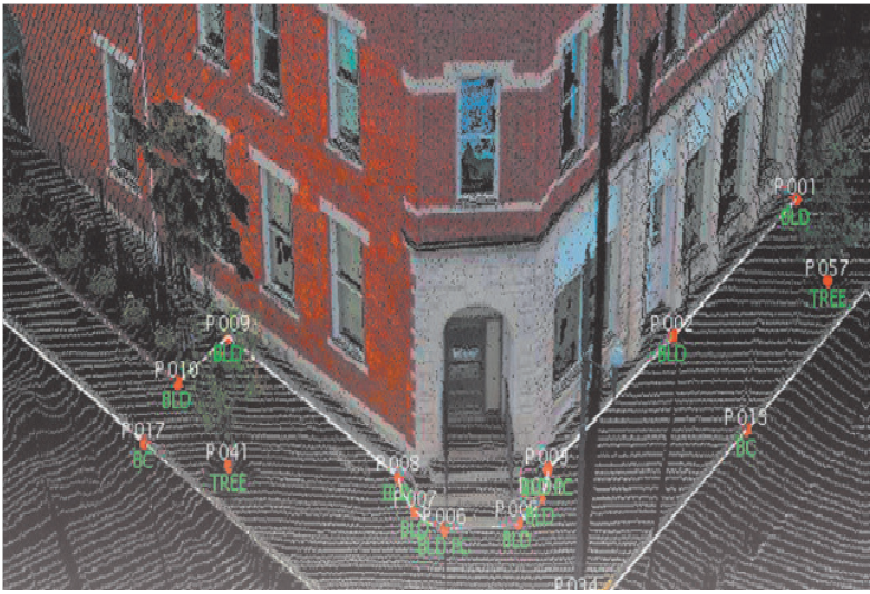
A modular program that provides the ability to go from field scan to finished plat, Carlson Point Cloud delivers powerful automation for large data sets. View and process up to 1 billion points all with Carlson ease-of-use.
Key features include:
- Register scans to local coordinates, filter or decimate the points, and overlay raster images in 3D
- Snap to edges and code descriptions for automated field-to-finish processing of linework and symbols
- Create contours, profiles, sections, and break lines from within the point cloud
- All surface models, points, contours, break lines, grid and profiles can be exported to CAD.
Data Extraction
- 3D extraction of poles, trees, and hydrants
- Extract data from clouds or meshes —TINs, Contours, Profiles, Sections and Break lines — and draw them in CAD design
Import / Export
- Import/export of grids
- Import/export point clouds containing up to 1 billion points
- Import more cloud formats, including LAS, Leica, Faro (requires installation of conversion software), E57, DEM, GeoTiff,
- and more
- Export to ASCII, LAS, or PDF
- Multiple Scan Consolidation
- Register multiple scans into one cloud
- Merge clouds
Anomaly Reduction
- Reduce anomalies with Clean Cloud and reduce density with Resample Cloud
Data Improvement Tools
- Continue data improvement with Smooth Mesh and Simplify Mesh (this reduces the size of the model by removing least significant data points
Field-to-Finish
- Use the full power of Carlson Field-to-Finish with Point Cloud data. You can use the same FLD files you use with GPS or conventional total stations with Symbols, Line Work and Labels all drawn in CAD
Viewing Cloud Data
- Colour Adjustment
- View multiple clouds at once
- Colour by Elevation or Intensity
- Adjust point size and cloud detail
- View as cross sections
Draw Linework
- Multiple snap modes to extract edges and slopes
Surface Data Commands
- Load Surfaces — Import scan data from various sources
- View Surface — 3D viewer for point cloud data
Scan Utilities
- Resample and filter scan data
Breaklines
- Automatic 3D breakline creation based on surface zones
Generate Profiles & Sections
- Trace an alignment across the site and generate profiles or sections
Carlson SurvCE & SurvPC.
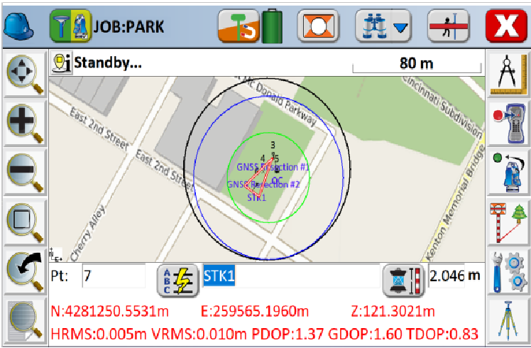
SurvCE (for Windows Mobile) and SurvPC (for Windows) combines advanced functionality, ease-of-use, and cutting edge features with excellent service and award-winning technical support.
Both SurvCE and SurvPC support the widest range of popular and newly released RTK GPS and conventional and robotic total stations, putting the power of Carlson’s in-field coordinate geometry at your fingertips.
Just a few of the powerful features to help you get your job done faster and better:
- Advanced Roading: favoured by heavy highway contractors around the world
- Cutting-edge functionality for staking intersections and cul-de-sacs using Carlson Road Network files
- Optional Field-to-Finish: Create drawings intuitively and automatically as you work, saving you time back in the office
- The highly graphical and intuitive user interface is designed ‘by surveyors for surveyors’
- Strong GIS features for accurate data capture, including attribute data and seamless linking to Esri®
- Easy data exchange due to rich support of CAD file formats and .dwg, .dgn, .shp
- More field capabilities with quick and easy volume calculation and ability to generate points from polylines
- Cut/Fill stakeout using surface files
- Camera integration allowing assignment of the picture to points or lines
- Export directly in KML format for fast control in Google Earth
True versatility: SurvCE and SurvPC run on hundreds of GPS and total station models in service today, including Altus, Ashtech, Carlson, Geomax, Leica, Pentax, Sokkia, Spectra-Precision, Stonex, Topcon, and more.

Carlson Survey GNSS Post Processing Software
For surveyors and positioning professionals looking to achieve centimetre accuracy when working on the edge of their RTK infrastructure, perform sub-centimetre positioning, and/or provide the highest quality assurance to their customers, Carlson Software has developed the all-new Carlson SurveyGNSS post-processing program.
Carlson SurveyGNSS at a glance:
- Supports differential post-processing of RINEX GNSS observations in static, ‘stop and go’ and kinematic positioning modes
- GNSS observations from any GNSS receiver in RINEX format
- Accepts proprietary GNSS observations in multiple formats
- Additional proprietary manufacturer file formats will be added based on manufacturer cooperation and/or customer demand
- Provides a straightforward, workflow-oriented user interface including an overview map and observation files, computed vectors, and positions presented in fully functional spreadsheet-like grids
- Incorporates a proven state of the science, highly autonomous baseline processor offering on-the-fly ambiguity resolution, automated cycle slip detection/removal, and more for baselines up to 200km
- Automated search and retrieval of reference geodetic control and GNSS observations from organizations such as the US National Geodetic Survey and Continuously Operating Reference Station (CORS) networks
- Automated search and retrieval of SP3 precise ephemeris files as well as ionosphere model files
- Rigorous least squares adjustment of all computed vectors
- Seamless integration with downstream applications from
- Carlson and other vendors
- Ready for the future: support of Galileo, Bediou and Juntencho signals as soon as these become commercially available

Carlson Survey Office software
Newly released Carlson Survey 2020 continues its development of survey features based on customer requests. The versatile and popular surveying software solution works like a surveyor thinks.
Highlights in the new release includes an added method to calculate a best-fit 3D line; improved cut sheet report with added functions to set and modify values for elevation, station, and offset, plus added method to import from TDS raw data; added method to renumber coordinates by adding prefix or suffix to point numbers; and for Deed Correlation, added method using polylines for input instead of points.
Top Features:
- Carlson Cloud: Transfer files and messages to SurvCE users in the field
- Lock Points: Lock selected points in the coordinate database to prevent modifications
- Field-to-Finish: New pipe network feature coding
- Google Earth: Added export for text, images and surfaces and import for points with photos
- Data Collection Interfaces: Upload and download to popular data collectors
- Traverse Adjustment: Spreadsheet editor for raw data with graphics and processing for traverse adjustments
- SurvNET: Advanced network least-squares for total station, GPS and level data
- COGO: Streamlined inverse, traverse, sideshot, intersections, interpolation, translate, rotate, scale and align
- Coordinate Transformations: Transform coordinates and screen entities between lat/lon and grid projections as well as local to local by Helmert and least-squares methods
- Cut Sheets: Create custom cut sheet reports with reference grades and station-offsets
Surface Commands
- Build Surfaces: By triangulation or rectangular grids
- Contouring: One step triangulate and contour from 3D entities as well as contouring from surface files
- Surface Manager: Change surface display properties and adjust surface functions to add and remove points and breaklines and swap edges
- Volumes: Earthwork volumes between triangulation or grid surfaces
- Pad Design: Tie cut/fill slopes from pad perimeter to surface, build pad surface, calculate and balance volumes, and edit pad parameters
Centrelines
- Design and Edit Centrelines: Design or input alignments on screen or in dialog with graphics
- Label Stations and Offsets: Annotate station and offsets along centreline and at selected points
- Calculate Offsets: Reports stations and offsets for selected points along centrelines
Profiles
- Create Profiles: From surfaces, screen entities, points on centreline, etc.
- Quick Profile: One step profile creation with real-time update while adjusting centreline
- Input-Edit Profiles: Enter profile data in dual spreadsheet and graphic window, and design in reference to controlling profile grade points
- Draw Profiles: Draws profiles on grids or plan-profile sheets with auto-updating based on edits
- Profiles To 3D: Create points and 3D polylines from profiles
Points
- Import/Export: User-defined import and export of point data along with conversions with specific other formats
- Draw Points: Draw points with settings for symbols, layers and styles
- Point Groups: Point group manager to define sets of point by filters
General
- Coordinate Systems: 100s of projections including SurvCE
- CSL Report Formatter: Create customized, professional reports
- Symbol Library: Hundreds of 2D and 3D symbols Project Setup: Flexible data storage methods
- Drawing Explorer: Manage and access project data files
- Drawing Clean up: Fix common drafting errors
- Drafting Enhancements: Handy tools for working in AutoCAD® such as Join Nearest, Shrinkwrap Entities,
- Polyline Utilities, Drawing Inspector, Layer Inspector and Twist Screen
- Data Compatibility: Supports industry standard LandXML and scores of specific data conversions
- Document Management: Use Data Depot for sharing and archiving files
- CAD Standards: Draw items with standardised properties
CPC Carlson Photo Capture
Aerial surveying is rapidly becoming a vital part of any surveyor’s toolkit. Thousands of people use drone site flyovers every day to help boost efficiency and lower costs.
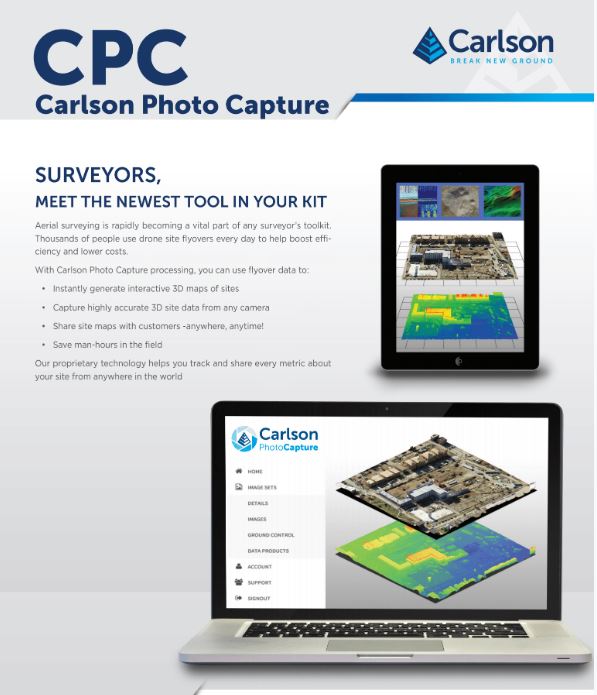
With Carlson Photo Capture processing, you can use flyover data to:
- Instantly generate interactive 3D maps of sites
- Capture highly accurate 3D site data from any camera
- Share site maps with customers -anywhere, anytime!
- Save man-hours in the field
Carlson’s proprietary technology helps you track and share every metric about your site from anywhere in the world.