
Geophysical equipment
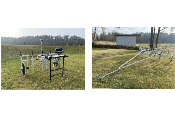
MAGNETO® MX V4
The MAGNETO®MX V4 is an area magnetometer survey system. It can host up to 16 fluxgate gradiometers on our unique modular metal-free and non-magnetic cart that can be set up as a pushcart or as a towed rig. Due to its modularity it meets the requirement of nearly any survey task. The cart can be converted into anything from a 1m wide push-cart to a 4m wide vehicle towed device. The compact data acquisition unit offers high sampling rates, 24Bit digitizing. It is prepared to host 16 probes. You can start with a lower number and extend the system over time just by getting a license and additional probes – no hardware change is needed. Equipped with an optional RTK DGPS the system allows geo referenced measurements of the survey area. Making it ideal for Archaeological and UXO surveys.
Features:
- Iron free carrier allows to push or carry up to 16 probes
- Vertical difference magnetometer with measurement range ±10,000 nT or ±8,000 nT
- Ruggedized tablet PC (IP67) for data acquisition
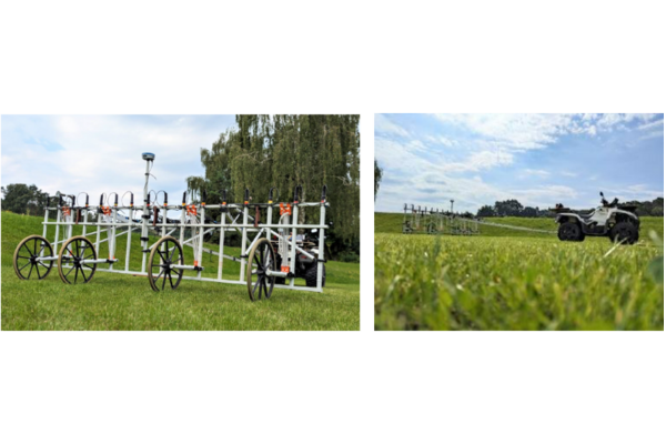
MAGNETO® MX V3
The MAGNETO® MX V3 is a large area magnetometer survey system. It can host up to 16 fluxgate gradiometers on a trailer having a width of 3.85m. This allows a rapid non-invasive cartography on land in order to search for UXO or archaeological structures as well as doing large scale soil evaluations.
Features
- Modular trailer to host 1 to 16 probes; to be carried, pushed or pulled
- Analogue highly sensitive fluxgate gradiometers
- 24Bit digitizer with LAN output wired or wireless (optional)
- Sample rate as high as 200Hz
- 25 ha max. daily cover at 15 KPH).
- Rugged tablet PC for storage and processing of measurement data
- RTK DGPS for position accuracy of ±1 cm
- SENSYS software suitable to record and process all measurement data
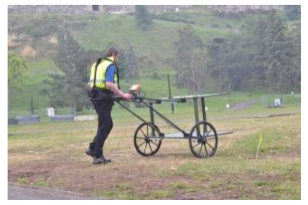
EDM2.2
The EMD2 is an active, highly sensitive system for middle sized area surveys using the TDEM („Time Domain Electro-magnetics“) method in order to detect metals in the ground.
It is made for high precision electromagnetic cartographies of small and middle sized areas in order to support UXO and EOD teams, geophysicists or archaeological surveys. The EMD2 comes with three pairs of differential coils giving a higher resolution for optimized identification of single objects. Measurement data is being digitized and logged with the compact EMD2 electronics.
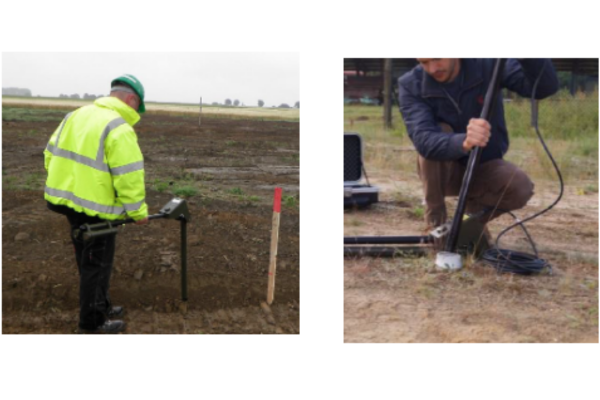
Iron Locator SBL10
The SBL10 is a very compact handheld device for detection of ferromagnetic objects in the ground. With only 3.7 kg and a clearly arranged control display, the SBL10 is easy and intuitive to operate. Due to its folding mechanism the SBL10 needs no assembly and is ready within seconds.
When being used with an additional probe FGM400/38 and cable (simply connected to the top of the SBL10 control unit) the device is ready for borehole or underwater surveys.
Features:
- Very light and compact UXO hand held detector - 3.7 kg operating weight
- Rugged FGM400 probe with detection range of ±30,000nT
- Simple and intuitive handling/reading
- No assembly of device needed due to folding mechanism
- Low power consumption/ intelligent power contro

ARCH1
Compact handheld magnetometer for Archaeology system.
The ARCH I is a very compact 3.7 kg handheld device for magnetometer based prospection of small to mid size or narrow areas for historical settlements and features.
The Z-gradient tension-band Magnetometer has a measurement range of ±3,000 nT range. So smallest signatures in the ground can be captured.
Recording and export of survey data is done via a rugged Android Smartphone and SENSYS GO App. Processing of the data can be done with MAGNETO® ARCH.
Features:
- 3.7 kg ops weight magnetometer with ± 8,000 nT range.
- Simple and intuitive handling/reading
- 120 h battery runtime.
MagWalk
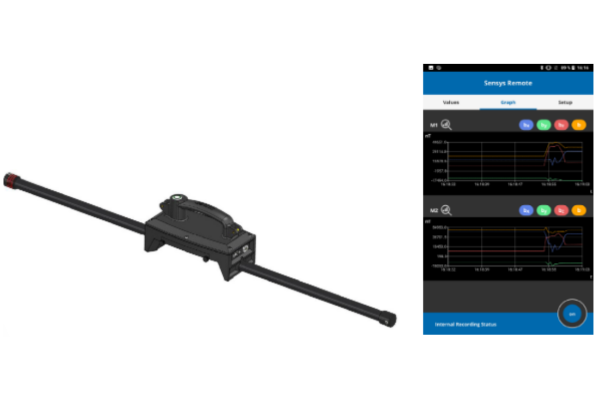
The MagWalk is an ultra lightweight portable magnetometer survey system that can be carried by one person holding it either transversely, longitudinal or upright beside the body.
The kit consists of a two built-in 3-axis Fluxgates. It has a 1-button data logger with internal SD card, rechargeable batteries, an integrated or external GPS as well as a serial live data output.
Features:
- Autarkic system with two sensors, GPS, accelerometer and battery
- 1,600g carrying weight
- 250 Hz recording rate
MAGDRONE R4
UAV / drone magnetometer survey kit
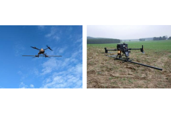
The MagDroneR4 is an ultra-portable magnetometer survey kit with five 3-axis sensors that can be attached to any drone (UAV) with a payload of >1500g.
The MagDroneR4 is used for high resolution mapping in order to detect small and compact objects as well as structures in the ground, such as bombs, ammunition or settlement features from the past. A sensor distance of 50 cm at a track distance of 2.5 m allows an area output of 3 to 4 ha per hour.
Operating the MagDroneR4 is simple. It only comes with one button and an onboard server to be accessed from any WIFI device, such as smartphones, tablets or laptops. That helps for any easy setup, configuration, system check, as well as remote start/stop of recordings and data download. The MagDrone Data Tool helps to identify flown tracks, cut, filter and compensate the raw data, generates a preview and exports into various formats to further process the recorded values i.e. using the MAGNETO® software, GIS tools or Matlab with your own scripting.
MagDrone R1
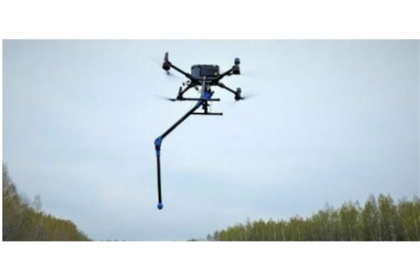
The MagDrone R1 is an ultra portable survey kit with an extendable Fluxgate sensor to be attachable to any UAV / drone with a 1+kg payload only.
The kit features a self-folding carbon fiber sensor arm to keep the distance to the ground as low as possible without risking the equipment. The built-in 3-axis Fluxgate can output serial live data with up to 1,000 Hz. The MagDrone R1 is optimized for small and mid size survey UAVs equipped with UgCS Skyhub or similar.
The survey kit can be used for general purpose surveys, science related magnetic cartographies, mine exploration or sensitive applications like UXO detection.
The MagDrone DataTool helps to identify flown tracks, cut, filter and compensate the raw data, generates a preview and exports into various formats to further process the recorded values i. e. using the MAGNETO® software, GIS tools or in Matlab.

MAGNETO® 3.0
Software for data analysis and interpretation
SENSYS MAGNETO® is software for the comprehensive analysis and interpretation of measurement data from magnetic and electromagnetic area and borehole surveys. MAGNETO® can be used for interpretation in UXO projects as well as for visualizing data in archaeological and geophysical missions.
Features:
- Display of measurement values as colour coded maps and borehole track plots
- Integration of site plans and pictures
- Multiple functions for displaying contour lines, symbols and text
- Object calculation of significant anomalies in colour coded maps and borehole track plots
- Creation of embedded object maps and -lists
- magnetic signatures simulation of virtual objects
- Importing and exporting data in many formats and different coordinate systems
- Filters for data processing
MagDrone Data Tool
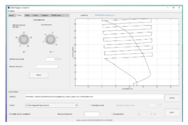
The MagDrone Data Tool is software for pre-processing the measurement data of all MagDrone models and the MagWalk and MagBase measurement systems. It exports the binary recorded measurement data into a readable ASCII format and can, if desired, preprocess the data.
Functions such as track recognition, various filter and compensation options and a colour map preview are available. The tool can combine MagDrone and MagWalk data with MagBase data.
You can choose between different export formats, which allows further processing of the data with the SENSYS software MAGNETO as well as third party software packages.